Taipei topographic map
You can find on this page the Taipei topographic map to print and to download in PDF. The Taipei elevation map present the topography, river and relief of Taipei in Taiwan.
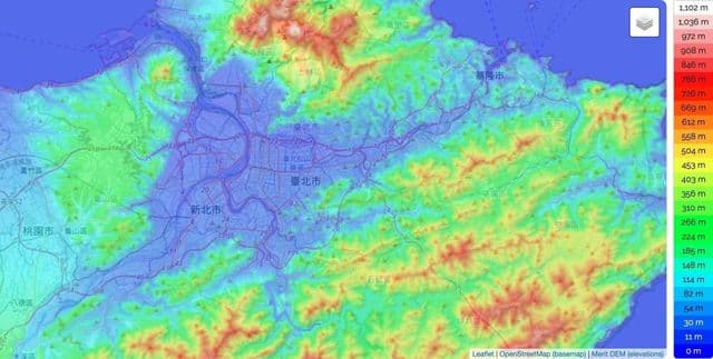
Taipei elevation map
The Taipei topographic map shows elevation, hills and landforms in Taipei. This elevation map of Taipei will allow you to know topography, river and relief of Taipei in Taiwan. The Taipei topographic map is downloadable in PDF, printable and free.
Taipei City is located in the Taipei Basin in northern Taiwan. It is bordered by the Xindian River on the south and the Tamsui River on the west. The generally low-lying terrain of the central areas on the western side of the municipality slopes upward to the south and east and especially to the north, where it reaches 1,120 metres (3,675 ft) at Cising Mountain (七星山), the highest (extinct) volcano in Taiwan in Yangmingshan National Park as its shown in Taipei elevation map. The northern districts of Shilin and Beitou extend north of the Keelung River and are bordered by Yangmingshan National Park. The Taipei city limits cover an area ranked sixteenth of twenty-five among all counties and cities in Taiwan.